
But the Superfund work is paying dividends. The ridge is recovering. And there are some starkly beautiful scenes that result. It's almost a shame to contemplate that eventually this area will just revert to the same old boring green-tunnel woods-walking that the AT has in abundant surplus.

There was, of course, the famous rock scramble up over the bedrock spine where the Lehigh River has cut its path. It was an invigorating challenge, more fun to climb than to descend. And it provided some great views. Today's walk is more about these beautiful views than anything else.

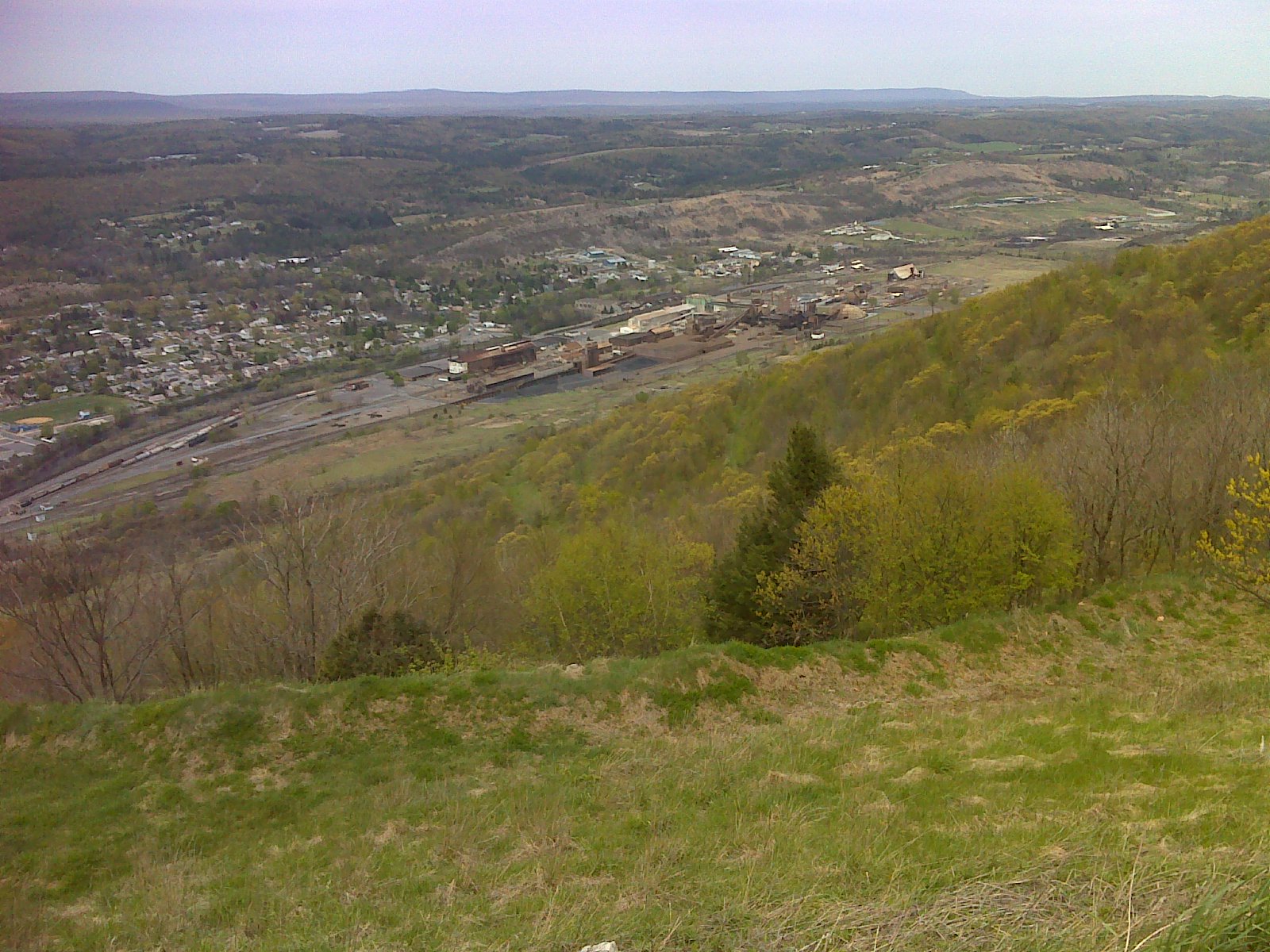
The Rocksylvania report: Of course the climb shown above was largely over big, untamed rock. But once you pass the upper junction with the blue blazed Winter Trail (when you reach the ridge top above Lehigh Gap) the relocation drops down to some very mellow side-hill walking on old road grades, now green with grass. The shot below shows Palmerton in the background. (Formerly, I'm told, the trail followed the ridge over another mellow old road bed.)

Either way, there are no more nasty rocks until you approach the Power Line clearing about a mile south of Little Gap. Then that temporary relocation along the Game Lands boundary from the power lines to Little Gap is frequently quite rocky. But who knows how long this bit of trail will last - only until the patch of ridge currently under restoration is finished, I suspect. So this report may become obsolete within a few years - or less.
As you can see, the weather cooperated nicely today. It was a short day of hiking for me, capped off with a return to my nephew's house in nearby Slatington (just a two mile walk from the trail at Lehigh Gap where, SHAMEFULLY, the AT does not provide a simple connecting walkway - down from the Lehigh River bridge - to the 165 mile long D&L rail trail), for some fellowship with family and a nice AYCE dinner at Valley Pizza in Walnutport. What a wonderful, fulfilling day!
-----------------------------------------------------------------
Below is the track - the route I took - for today's hike. Near the left end (by Lehigh Gap) you'll see where I took my first serious wrong turn in 108 days of hiking. A double blaze marking a turn coming down off the rocks was vandalized - overpainted brown - where the trail turns right, dropping over rocks and a more obviously visible and well-used trail goes straight. This trail ends up in the same place, at the AT trailhead parking lot, but it is *not* the AT, so I had to backtrack - I'm a purist and want to "Pass every white blaze" - twice, in fact. The photos that are available through the link below show where the other end of that wrong trail, which is marked with red arrows, comes out at the parking lot. AT Day 108 - the EPA Superfund site at EveryTrail
EveryTrail - Find the best Hiking near Allentown, Pennsylvania
I'm really enjoying your journal and journey. Is this is zinc smelter area Bill Bryson wrote about? If so, I'm glad you posted photos -it's much more extensive than I imagined and we need images like this to remind of us how much impact we do make when making the wrong decisions. Best of luck with your shoulder and ankle and I look forward to reading more, especially since you are a front runner and highlighting the trail my son, Loner, will hike later since he started his thru-hike a good bit behind you on April 7th from Amicalola Falls.
ReplyDelete