Showing posts with label Benton MacKaye Trail. Show all posts

Friday, August 28, 2015

Farewell Benton MacKaye, hello Pinhoti Trail


"Florida or Bust" - Days 7 and 8

This report could have several headlines.

Headline One (the one I actually chose) concerns my final day of hiking the Benton MacKaye Trail, as I reached the junction with the Northern Terminus of the Pinhoti Trail.  Here's the whole sign, since it didn't all fit in my selfie:


The BMT blaze is a white diamond.  In one place a maintainer's chainsaw mark has been embellished with paint.


It's a distinctive mark, so on my last day I picked up a little quartz pebble with the diamond shape.  It will be my souvenir of a wonderful week of hiking.  The fallen leaf is a small reminder that autumn is not far away.  It's been cool in the mountains already, and color change is beginning.


The Benton MacKaye Trail is a sister trail to the Appalachian Trail, but far less traveled, and so a much more quiet, natural experience.  I'll remember it all my days.  Maybe I'll come back and hike the rest of it some day - in small pieces during the summer, the way I'm finishing the Mountains-to-Sea Trail.

Headline Two:  My walk over Flat Top Mountain - the only mountain I know with a beautiful old oak tree at its very summit.  The photo says everything else on that subject.


And Headline Three:  More mushroom discoveries, as the recent rains continue to send fungi into reproductive frenzy.  Here's some mushroom art - looking down at a flat-topped cap of a species I've not identified:


Here's a wider view of another individual of the same species:


I found a couple of giant puff balls.  Cut them in slices and sauté them in butter and you've got a meal.


And here's an irresistible shot of the 'Mutt and Jeff' of the mushroom world - the tall and the small growing side-by-side:


Finally another odd variety that I haven't identified.  Species with hollow centers use rancid scent to attract bugs - they come in and collect spores the way flowers attract pollinators.


Now it's on to the Pinhoti Trail on which I'm headed west toward Dalton, GA.  At Dalton the hike will go into a planned 'hold' while I visit family and take care of some business, and then Southwest into Alabama.

Here's a map of my trek over Flat Top and on to the start of the Pinhoti.


BMT - Bushy Head Gap to Pinhoti Trail at EveryTrail
EveryTrail - Find trail maps for California and beyond

The Benton MacKaye Trail gets creative through private land

"Florida or Bust" - Day 6

New Construction of high-buck mountaintop homes puts the BMT in several front yards.  Trail follows the wood chips.

Let's make this quick and simple.  Today's hike included two lakeside walks, two non-historic covered bridges, a boardwalk, a standing stone, a real hiker shelter, a quaint little chapel in the woods beside one of the lakes, and a trailside picnic table where the trail follows a stream with several small waterfalls.

It was a wonderful stroll.  And it was all on private land and on public roads.  I got lost once on top of a mountain among a confusion of twisting roads and new construction, but the trail was there -- I found the one piece I missed on the return leg.  I hiked from US 76 generally west over a couple of ridges and through residential and rental-cottage neighborhoods that felt crowded despite the deep shady woods.  But there were also some secluded stream-side walks too.  Then the day ended with a 2.5 mile road walk up to Bushy Head Gap.

The shelter was within sight of a house perched on a hill, but it was clearly a labor of love -


And it came complete with a register book.  So I left a note.


Okay, so here is a photo-tour of the rest of the highlights I mentioned:

Little covered bridge with its own separate walkway for the trail.
Indian Rock
The lake near Indian Rock
Boardwalk with steps down to a second lake
The second lake
Little chapel right on the second lake
The chapel wasn't locked
The road walk

Lastly, here's the map of the day's trek, as recorded on my trusty GPS:


BMT - US 76 to Bushy Head Gap at EveryTrail
EveryTrail - Find trail maps for California and beyond

Wednesday, August 26, 2015

The Benton MacKaye Trail from the Toccoa River to US 76

"Florida or Bust" - Days 4 and 5


Fall Branch is not a big stream, and it's not very long or otherwise distinctive, so obviously they named it for its waterfall.  It's a beautiful robust double cascade--well worth the quarter mile hike from the trailhead, especially with all the recent rains.  As you can see from the trampled ground, this is one of the most heavily walked sections of the Benton MacKaye Trail.

So ... the stream is called Fall Branch.  What did they call the waterfall itself?


Creative. 

Fall Branch Falls was one of the highlights of this section of the BMT.  After leaving the Toccoa River headed northbound (for me it's southbound.  In compass directions it's westbound) there is a three mile road walk to the Fall Branch trailhead.  After passing the falls, the trail climbs about 1400 feet, joins forces with a Mountain Bike Trail called the Stanley Gap Trail for a couple of miles, then drops back down 1400 feet to a trailhead at the end of Weaver Creek Road.

It's all beautiful, serene woodland in that section, far from civilization.  But then the trail is tasked with negotiating about nine miles through private land on either side of busy four-land divided highway US 76.

Serene woods is good for flower pictures and mushroom hunting, for listening to the birds and communing with wilderness, and for views if there are any (which there weren't).  But walking the bits of trail cobbled together through private lands and on old abandoned roads and lesser used residential roads has its own charms.  There was this wooden 'bridge' with an identity crisis.  The wood is laid on the stream bed.  It's really a ford.


There was a horse who seemed to be in a rather sticky situation.


And there was a good long field walk along the edge of a fallow 100 acres or so.  I love it when I can hike under the open sky, since it happens so seldom on trails east of the Rockies.


The end of my day was at US 76, where the trail crossing is well marked.


And up the highway about a half mile is the Benton MacKaye Trail Headquarters.  It's a rustic log building, but doesn't look like it's ever manned with staff ready to greet visitors.  It's more of a glorified shed.  Note the faux covered bridge.  As you'll see in my next report, the trail goes directly 'under-roof' of two more of these.  Stay tuned.


Below is a map of the trek reported in this post.


BMT - Toccoa River to US 76 at EveryTrail
EveryTrail - Find trail maps for California and beyond

Tuesday, August 25, 2015

Hiking back to the Toccoa River

Florida or Bust, Days 3 and 4.


The Benton MacKaye Trail crosses the Toccoa River three times.  As part of my route to Florida, which only uses the about 65 miles of the BMT, I cross it twice.  The first time was at the 'Swinging Bridge' - a suspension footbridge - covered in the Day One report.  The second is at an old one-lane wood-decked iron truss bridge called the Shallowford Bridge.

To get there, of course, the trail finds as much wilderness as it can, and so it has to go up over the tops of mountains and along ridges.  It is remote and pretty country for the most part, through on top of Brawley Mountain there's an old lookout tower now serving as an antenna farm, and the access road provided me with an alternative route up from GA 60.


Coming down from Brawley Mtn. to the Toccoa there's a net elevation change of 1200 feet, and to add to the fun, there's a second summit with a 400 foot climb.  But then the trail levels off and follows the river for a mile or so.

This section of the Toccoa River is known for its tubing adventures.  Several companies cluster at the Shallowford Bridge, take their clients upriver about three miles to a public canoe launch, and let them drift the rapids.


It's a noisy restless river, but it was a rainy morning on the day I passed through, so activity was nil.


Just the sights and sounds of nature.  That's the way I like it.  The encounter with the river ended where the road walk took a turn up Stanley Creek.  At the intersection, set right on the river, is the Toccoa River Restaurant.  I didn't go in, but appreciated the neat, inviting street-side presence, which included this tree stump carving.


Below is a map of the route, done in three out-and back sections.


BMT - Wilscot Gap to Shallowford Bridge at EveryTrail
EveryTrail - Find the best hikes in California and beyond

Florida or Bust, Days 2 and 3

Two Colored Boletes and a mess-o-puff-balls

Subtitle for today could be "Mushrooms and Morning Glories"

I spent the night at the very hiker-friendly Skeenah Creek Campground just a half mile from the trail on GA 60.


There I met David Killion, amicable host, and some of his mushroom enthusiasm rubbed off on me.  It has been very wet these past few days in North Georgia, so the woods are popping up mushrooms in abundance.

I'd known for a long time that puff-ball mushrooms are edible as long as the interior remains pure white, but David showed me pictures of the family of mushrooms called Boletes, and so I was on the lookout for those huge, heavy, meaty gems.  I carried the five best with me and brought them back as a present for David.

I left many more in the woods.  My favorite visual treat is the Shaggy Stalked Bolete.  According to the internet experts, these are edible but not very good tasting.


Also encountered was one far less appealing, creepy looking fungus 'flower'.  This one is called the Elegant Stinkhorn, and it really has a putrid smell.  This is a fungus in the family Phallaceae - easy to see why they picked that name.


The hikes covered in this report cover about fourteen miles of Benton MacKaye Trail from the 'Swinging Bridge' over the Toccoa River, across GA 60 and on to Wilscot Gap where the trail crosses GA 60 again.  I was able to do the eleven miles of trail between the GA 60 crossings and take a short-cut back to the beginning-point by road-walking GA 60 - it's just 4.3 miles by road.

Along the road I encountered my favorite variety of Morning Glory.  It's one that blooms in four distinctive colors, seemingly all on the same plant.  And each of the colors is stunning - deep royal blue, light blue, pink and white:


And right beside it was a showy but diminutive Scarlet Star Morning Glory:


Hiking trail in the woods can be dull when there are no views - it's all trees and dirt.  I had only one view all day, but the day was anything but dull thanks to the fungi and the flowers.


Here's a map of the hiking route--BMT one way and roads the other over two legs.


BMT - Toccoa Swinging Bridge to Wilscot Gap at EveryTrail
EveryTrail - Find the best hikes in California and beyond

Saturday, August 22, 2015

Starting the new adventure, hiking to Florida from the AT


Here is where the trails fork, and this time I'm taking the "road less traveled".

It was the morning of Day One of my 'hike to Florida'.

I started the day at Three Forks, which is the second road the Appalachian Trail crosses as it winds northward from its southern terminus at Springer Mountain.  All but the least ambitious Northbound AT through hikers would pass this parking area on their very first trail day out.  It is 4 1/2 miles from Springer Mountain.
As I hit the trail I met some trail maintainers from the local Georgia Club and talked to a lady who knew AT Conservancy board member Lenny Bernstein (who I had met while hiking the AT in the area of Sam's Gap where he maintains a section).  She also knew quite a lot about North Carolina's Mountains to Sea Trail.  It was a short chat, as her first task was to take water quality samples from Long Creek not far from the parking lot.

Half a mile later I was at the side trail to beautiful Long Creek Falls:


And that is where the Benton MacKaye Trail and the AT part ways (photo up top).  My plan is that I will head northwest on the BMT for about 65 miles to where the Georgia Pinhoti Trail splits off and heads west.  My route then takes me the full length of the Pinhoti Trail through Georgia and northern Alabama.  From there I will use a road walk connection established by the Great Eastern Trail to get to the Florida border where I'll pick up the Florida Trail.

That's the big-picture plan, and it fits into an even bigger picture--my 'Personal Continuous Footpath'.  I'm laying down footprints via connecting trails and road walks that are uninterrupted--all one big web of foot trail that includes the Appalachian Trail as its spine but has also seen me connect to my Topsail Island home via the Mountains-to-Sea Trail and to many places I've lived in Maryland and Delaware via bits of the American Discovery Trail and other trails.  The goal of this 'Personal Continuous Footpath' is to connect, on foot, with every house or condo or apartment or dormitory, etc., that I've ever lived in.  Since I'm buying a place in Florida in order to take up residence there next, it's my winter project to hike to the front door of that new home.  But ...


Today's endeavor was much smaller in scale--to settle in to the Benton MacKaye Trail and get used to following its white diamond blazes.

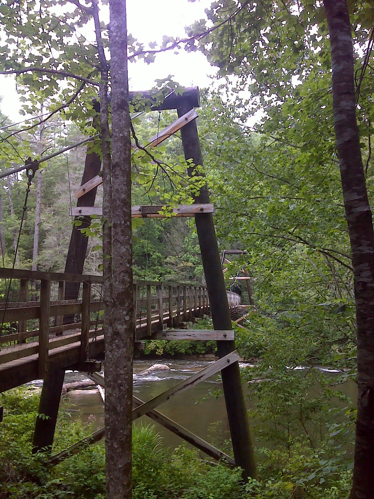
As I suggested above this trail is far less used than the Georgia AT, yet it is well maintained and blazed and easy to follow.  After Long Creek Falls it climbed up to a ridge and followed that for five miles or so before plunging about 1200 feet in elevation to the Toccoa River where the US Forest Service and Georgia Appalachian Trail club have built a most impressive suspension foot-bridge.  It's no small river.


That was my turn-around point for a 16 mile day.  Weather was cool and humid, but reasonably comfortable.  I'd say that the new adventure is off to a good start.

Here's a map of the out-and-back hike I accomplished today--about 8.3 miles of trail including one mile of AT that I had hiked in 2012.


Benton MacKaye Trail - Three Forks to Toccoa River at EveryTrail
EveryTrail - Find hiking trails in California and beyond