Tuesday, July 31, 2012

One tough day

Tuesday, July 24, 2012:

It took nine hours to hike five miles of trail today - virtually all of it difficult.  This was the section of the AT called the Wildcat Ridge Trail.  Here's what the AMC guidebook says about this trail:

"The sections from Lost Pond Trail jct. to E Peak and from A Peak to Carter Notch are very steep and rough, and there are several ups and downs and other steep, rough sections along the rest of the trail that make it more difficult and time consuming than one might infer from a casual glance at the map or the distance summary."

And a sample of the south-to-north detailed trail description:


" ... Lost Pond Trail enters on the left and the trail shortly begins the very steep climb up the end of the ridge (use care on all ledge areas).  The first pitch up rock steps and a ladder leads to an outlook across Pinkham Notch.  After a tricky traverse and a fairly difficult scramble up a rock chimney, the trail crosses a ledge with an excellent view of Mt. Washington ..."

I'm really glad I bought the AMC guidebook.  Its trail descriptions are much more practically useful than those in the AT official guidebooks - more along the lines of what I've been trying to write in this blog - descriptions of the nature of the footpath itself, not just a list of landmarks that you pass.  And the AMC guide provides hiking times between landmarks on all of its trails.  Those times are a huge help in planning.  They have proven to be very close to my actual hiking times (I guess I'm an average hiker overall).

So I knew I was in for tough trail today.  What I didn't bargain for was all the rain showers.  There were five or six of them during my 9 hours on the trail.  None of them were heavy or long lasting, but they kept the rock wet, and with all the sketchy footing on sloping bedrock today, my pace was excruciatingly slow, especially on descending.

Of course, when you're on such rugged trail, you expect some rugged vistas.  And the weather gave me a break as I passed the best of them.  Here's the view down into Carter Notch, with the Hut 1000 feet below beside its little lake:


And at the other end of this bit of trail, the views of Pinkham Notch weren't too shabby either.  Here's a look down on the Visitor's Center:


Not only was it a slow day, it was tiring.  I started with fresh legs, having taken a zero day yesterday.  But by the end of the day I was well and truly worn out.  For those of you considering an AT thru-hike or some other variant that takes you through the White Mountains, make allowances in your planning for your daily miles to drop considerably.  Its a beautiful place, but in some sense you could call the White Mountains "Pennsylvania on steroids" ... or "Pennsylvania with mountains and views" ... or "Pennsylvania with huts and tundra".  The point, which I've not heard verbalized before, is that when all else is said and done the White Mountain trails are *rocky* with a capital ROCK.

-------------------------------------------------

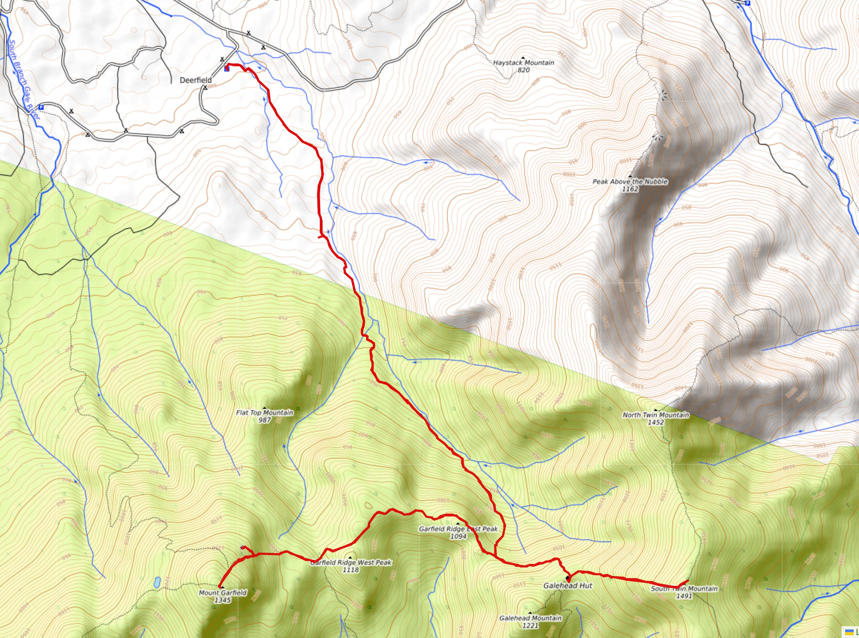
Here's the map of today's hike, with a link to more photos:

AT Day 186 - Wildcat Ridge at EveryTrail
EveryTrail - Find hiking trails in California and beyond

Let's talk Laundromats and trail diet

Monday, July 23, 2012:

Okay, after more than a month since my last laundry break, I needed a zero day to de-scuzz my wardrobe.  I chose today because the weather had turned hot, sultry, and humid with an increasing threat of showers and storms and heavy rain, anytime after 11AM.  It actually sprinkled some between sunrise and 7AM too, so I figured I had 'chosen wisely'.

Now ... I had checked out the *Scum Pit* laundromat in Gorham.  Sorry folks, it's actually called the Laundry Basket, and it's really conveniently hiker-located right next door to the post office.  But 70% of the machines were out of order.  And the vibes were pure 'scum-pit'.  On my scouting visit I couldn't get out of that place quick enough.  It's like some of the laundromats I remember from college days where your laundry comes out dirtier than it went in because of the toxic waste residue that previous users were trying to wash off their clothes.  People go into laundromats like this in order to wash things they wouldn't allow in their home washing machines.

But being blessed with a vehicle, and a whole free day to use it, I had the luxury of many more options.  I chose to drive 120 miles back to West Lebanon, NH to a laundromat that had caught my eye.  It's run by Kleen, Inc., a 100-year-old local family business that also does hospital laundry in their central plant.  This laundromat and dry-cleaning outlet is open 24 hours.  There was a friendly, cheerful and very helpful attendant, and dozens of machines of all varieties, with only a few out of service.  The place was bright and clean and fresh (the attendant mopped the floors while I was doing my laundry),  and is virtually right next to the I-89 West Lebanon exit in the K-Mart shopping center.  Through all my life experience, this is by far the most immaculate, welcoming, non-sleazy laundromat I've ever experienced.

I got my laundry done early then did some shopping, restocking favorite trail foods, some of which are not easy to find. Most particularly, the Jalapeño string cheese sticks that are my anchor and staple on the trail.  Only a minority of full-sized grocery stores carry these.   Everybody and his uncle carries the regular Mozzarella string cheese sticks; but to me they are bland by comparison.  The Jalapeño-flavored ones are much harder to find, and much more savory.  It's not just the (mild) 'heat', but the flavor.

String cheese sticks need to be refrigerated, but they last 24 hours easily without it.  They're classic kids' school lunch-box food, and the Jalapeño version is good enough that I'm willing to drive 120 miles out of my way to stock up on, especially with the great laundromat across the street.  I bought 20 packages.

These perfectly complement my other trail staples:  Flavor-Blasted Goldfish (a custom mix of one quarter Pizza flavor and three-quarters Extra Cheddar flavor that I blend as needed) and good old original Oreo cookies ("Milk's favorite cookie"), bought in family packs.  Milk is my 'at-home' cooler staple - have a half liter of it for breakfast and again as soon as my hiking day ends every day.

On the trail, to avoid 'hitting the wall', I have a 'feed' every 2 to 2.5 miles of hiking (depending on trail difficulty), which consists of one Jalapeño cheese stick, one full mouthful of flavor-blasted Goldfish crackers, and two to four original-recipe Oreo cookies.

I could live on this diet for the rest of my life :-)   Although both Goldfish Crackers and Oreos contain a surprisingly generous helping of fiber, I also carry and consume five Sunsweet prunes a day - my morning 'constitutional' - three on the first feed, two on the second.  I love the flavor of prunes and they keep the cheese from clogging up the old tubes.

So today was a classic Zero Day.  I got the town chores done, restocked, and was ready to head back to the trail.  Only difference - the town was 120 miles from the trail.

----------------------------------------------------------

Monday, July 30, 2012

Four Shelters and a pond

Sunday, July 22, 2012:

The Randolph Mountain Club maintains about 100 miles of trail in the White Mountains, mostly on the north side of the Presidential Range.  Here they also operate four shelters, all clustered within a few miles of one another and all within a mile or two of the AT ... so they are officially named in the AT guidebooks as trail shelters.  Nevertheless, evidence from the log books at these shelters suggests that few AT long distance hikers venture down to any of them.  To do so requires 1000 feet or more of descending (and then climbing the next morning), and there's the Madison Spring Hut right on the AT not far away.

But ... one of the goals I've set for myself on this adventure is to visit and photograph every official AT shelter.  I couldn't do it by coming down from the AT, so I took a separate day - today - to come up from US 2 via the Lowes Path and do a 7.8 mile circuit hike to visit all four at once.

It took most of the day and I never touched the AT.  Finally late in the afternoon I went back over to Pinkham Notch and hiked 0.9 miles of official Appalachian Trail - the Lost Pond Trail.

That was today's itinerary - it felt like I was wrapping up loose ends.  The weather was getting hotter and the visibility was down (just 30 miles on Mt. Washington).  It was a good time to get this 'chore' done.

And as it turned out, the 'chore' led to some interesting experiences.  I got to hike some of the lesser known trails around the Whites and learned to appreciate these diverse 'Paths' as they call them.  Many of them were built as far back as the mid 1800's, and most were in place before 1900.  And they reflect the personality of the trail builders.  Some are wicked steep, built by the macho types, such as the upper end of King Ravine Trail.  Others are deliberately gently sloped, such as Randolph Path.  It seems Mr. Randolph was of the opinion that ladies in their full skirts should be able to walk his path comfortably.  It sidles its way along the slopes all the way up to the ridge at Edmand's Col, never very steep, though I can't see ladies in their finery scrambling over some of the oversized rocks that the Randolph Path negotiates.  Yet I did see evidence of some old steel pins and such - perhaps one day long ago there were fixtures in place that made the going easier than it is today.  It's said that some of the macho types refused to hike Randolph's Path, declaring that it was for sissies.  If I hadn't made today's hike, I would have been oblivious to all this rich and varied history of the trails and the trail building pioneers in the Whites.

And I would have missed the palatial Crag Camp Shelter.  This place is every bit as luxurious as a hut except for the fact that the caretaker doesn't cook for the visitors.  The interior is bright and clean and roomy.


The living and dining space has a vaulted ceiling with two-story picture windows that look over a vast rugged cirque (King Ravine) on the slopes of Mt. Adams with the summit of Mt. Madison beyond.  It's a view to die for - and it only costs $13 to stay there in one of the three bunkrooms.  AT hikers take note!

Finally in the afternoon I did Lost Pond - a gnarly little bit of trail that you might expect, based on the map, to be easy and flat.  After all, it just follows the highway for a mile before handing the AT over to the Wildcat Ridge Trail for the serious ascent north out of Pinkham Notch.  But this little bit of trail struggles to get you through some major boulders and has a bit of climbing/descending on either end.  In the middle, perched above the valley and appropriately hidden from the highway is Lost Pond, here reflecting Mount Washington's summit.

So it was a day with little forward progress, but a ten mile hike that was special in many ways.

----------------------------------------------------

Below is a map of today's two separate bits of hiking: the 7.8 mile loop to visit the shelters up north, and the short bit of AT in Pinkham Notch at lower right.  Unfortunately the two hikes are connected by a straight line that is an artifact - the EveryTrail software connects points on a track whether they should be connected or not.  If they only plotted the actual points recorded by the GPS, this line wouldn't be there.  Anyhow, the red pins show where I took photos, and you can see them by clicking the title line above the map:

AT Day 185 - Lost Pond, Pinkham Notch at EveryTrail
EveryTrail - Find hiking trails in California and beyond

Saturday, July 28, 2012

Wrapping up the Presidentials

 
Saturday, July 21, 2012:

On another near-perfect weather day, I finished the traverse through the 26.0 mile section of trail between Crawford Notch and Pinkham Notch.  I did this section north-to-south first, parking at the huge and hugely popular Pinkham Notch Visitor's Center.  The AMC really knows how to run a hiker-friendly place.  Despite the vast hoards of visitors today - a Saturday with perfect weather and vehicles filling the lots and lining the "NO PARKING" shoulders of the highway in both directions as far as the eye could see - the place seemed calm, welcoming and friendly, and the staff took the time to answer your questions and then check to be sure you had been satisfactorily helped.

From the visitor's center the AT takes the Old Jackson Road on a gentle ascent of a couple miles to the Mt. Washington Auto Road crossing.  Then it's the Madison Gulf Trail and it climbs steeply for a bit to a knob called Low's Bald Spot, descends surprisingly steeply into the Great Gulf Wilderness where it hooks up with the Osgood Connector and takes you across the rambunctious Parapet Brook that drains the whole Gulf off the slopes of all those famous Presidents (plus Henry Clay).

Once you reach the Osgood Tent Site the Osgood Trail proper begins and your steep but not overly daunting climb up the Osgood Ridge to Mt. Madison begins.  It's 2800 feet of climbing, but it only gets seriously tough for one short section of jagged person-sized rocks on a steep section of the ridge above timberline.

I'm featuring some nicely constructed and sturdy cairns in today's photos, both high on the slopes of Mt. Madison.  The one up top looks toward Mt. Washington with Pinkham Notch to the left.  Below is a view in the opposite direction, with the towns of Gorham and Berlin in the broad Androscoggin valley.


And finally, I want to show you a morning shot of Mts. Adams and Jefferson making their own clouds:


As you can see, the views were magnificent once again today.  I'm going to miss this section of trail, but the memories now etched in my mind will not quickly fade.

-------------------------------------------------------------

Here's the track of today's hike as recorded by my GPS, with a link to more photos:

AT Day 184 - Osgood Ridge at EveryTrail
EveryTrail - Find the best hikes in California and beyond

Mount Washington on a perfect day

... and a big personal milestone - 3000 miles of AT hiked this year!


Friday, July 20, 2012:


Some days you just get all the breaks.  Today's summit weather on Mt. Washington was as ideal as it ever gets.  At right are the official observations.  The first column (20) is the date, next is the time (24 hour format, Eastern Daylight Time), then wind direction and speed in miles per hour, visibility in miles, cloud cover, cloud measurements, temperature (F), dew point (F), etc.  The point being that visibility was perfect (130 miles), wind nearly calm, and temperature cool but pleasant all day long.  This is rare.  And it led to some great views.

Here's the big mountain as seen from across the 'Great Gulf' on the slopes of Mt. Adams:


And here's the view in exactly the opposite direction, taken from Mt. Washington, with Mt. Adams right of center and Mt. Jefferson left:


And here's the 'Great Gulf' - a vast closed-end valley that lies between.  Mts. Adams and Madison are at left (Madison is the lower, pointy peak farther away than Adams):


I hiked that entire U-shaped route - following the ridge around the Great Gulf from Mt. Washington to Mt. Madison and back, almost always above tree line, so nearly constantly bathed in vast panoramic views all day long.  It was Nirvana!

Along the way I dropped down to visit the newly rebuilt Madison Springs Hut (check this cool video of the hut's history and rebuild).  This shot shows the hut in its context, with the sharp summit of Mt. Madison behind:


And I watched as the first train of the day came up the Cog Railway line - technology from the 19th century.  Just look at that disgusting pollution cloud casting its shadow over the forest.  That's the Mt. Washington Hotel in Crawford Notch in the background with Franconia Ridge clearly visible beyond:


I call the shot below 'The Scouring of the Shire' because it reminds me of Tolkien's passionate contempt for how the dirty, noisy machine age was destroying the quality of life in his time.  This railway is a throwback to that age.  That's Lakes of the Clouds Hut playing the role of Hobbiton behind:


So all was not perfect in paradise.  But the Old Indian on the north slopes of Mt. Madison seems to be cracking a smile as he peers out over his exquisite vista.  I think he liked what he was seeing today :-)


----------------------------------------------------

Here's the map of today's hike, and a link to all the rest of the good photos I took today:


AT Day 183 - The Presidential Range at EveryTrail
EveryTrail - Find trail maps for California and beyond

Friday, July 27, 2012

The Big Summit

... or in like a tourist, out like a pro ...

Thursday, July 19, 2012:

The big one - Mount Washington - was on the agenda today.  But logistics demanded that I drive to the summit before hiking.  It felt awful, arriving without any effort, mingling with the tourists, checking out the full service snack bar, gift shop and museums.  I never felt so *not* like a hiker while actually standing on the Appalachian Trail setting my foot officially on the Geodetic Survey marker at the precise summit before heading out.  There I was mingling with the giddy groups of shivering folk getting their photo-op at the summit marker on this windy (30-40mph), chilly (39F when I got there, high at the summit was about 46F), morning.  Wind chill was below freezing.

Then off I went, into my element, where the crowds don't go.  Lakes of the Clouds Hut is not visible to the tourists from the summit, though it's a hot destination for the hiker-tourists - accommodates more than 100 at a time - and a lot of them were beginning their ascents as I came down.  It was a pretty sight, tucked at the base of Mt. Monroe.  Pretty close-up too, with one of the two little 'lakes' in the foreground  (that's the huge Mt. Washington Hotel down in the valley behind):


As you see, visibility-wise it was a perfect day to be on Mt. Washington - official visibility was 100 miles.

Okay ... I've avoided showing the summit.  No shots full of random yammering tourists for me.  No clutter of buildings and towers.  It's a rare perspective, but as luck would have it I did get my kind of shot of the actual summit of Mount Washington, free of tourists, buildings hidden by the rocks, and taken from the hiker perspective - looking for directions to follow, this is the sign near the snack bar, with the actual summit sign behind:


And this is what the summit looks like from the Hut lake:


The trail goes around the actual summits of three more mountains before going over Mt. Pierce (where I turned around and came back north).  But being out in the open tundra, the views are endless and superlative.  Here's the view of Mt. Franklin looking south from the slopes of Mt. Monroe:


And here's the next view - of the meandering walk toward and around Mt. Eisenhower, taken from the south side of Mt. Franklin:


The trail was relatively easy today - lots of rocks but no serious scrambling, even plenty of level walking.  I still prefer the grassy high meadows of Hump Mountain in the Roan Highlands, but today's walk ranks up there among the truly memorable ones.

And the best part: I come back tomorrow, hauling my two ton steel tent to the summit again, playing tourist for a few minutes, and then heading north around the Great Gulf and across the iconic saw-tooth spine of the northern presidential range.  Weather promises to be even better tomorrow - visibility at the summit is already up to 130 miles as I write this, and the wind is forecast to be light under sunny skies.  Got my fingers crossed ...

------------------------------------------------------------------------

Here's a plot of my route on a map, with a link to all the other photos I took that I thought were worth showing:

AT Day 182 - Mt. Washington, north side at EveryTrail
EveryTrail - Find trail maps for California and beyond

Thursday, July 26, 2012

Webster Cliff Trail, end to end

... featuring 14 cliff-top vistas, three summits and a hut - plus a first close-up look at Mt. Washington ...


Wednesday, July 18, 2012:

The bad-weather day and my rest day were over.  The last of the rain was out of the area before midnight, replaced by windy mild air under partly cloudy skies.  The full effect of the coming Canadian airmass wouldn't get here until tomorrow, so today was a transition day weatherwise.  As you can see from the photo above, taken from Mt. Pierce, Mount Washington was still scraping the clouds most of the day.  It did clear up, right when I was at my turn-around point where the Webster Cliff Trail ends and the AT takes up the venerable old Crawford Path.  You can see all the towers on the summit in the view at left.  The closer-in peak is Mt. Eisenhower.

The other end of the Webster Cliff Trail is down in Crawford Notch.  And the climb up is dang tough!  There's one piece of bedrock scrambling that's the steepest 30 foot climb anywhere on the trail, as far as I recall.  Otherwise there's lots of rock scrambling ... and this bit of trail would be heaven for the hiker who loves wind in their face, views over a brink where the land below your feet is out of sight (so it's just you and the vast chasm of Crawford Notch).  I counted fourteen such open, cliff-top viewpoints ranging from about the 3000 foot level on up to the 3800 foot summit of Mount Webster.

Then the trail gets easier, by White Mountain standards.  It meanders through a saddle between Mt. Webster and Mt. Jackson with level trail punctuated by little gnarly rock scrambles, up or down, seemingly at random.  Then from Mount Jackson's open summit you get to see the walk you are about to make through the next saddle, which features some board walking through a boggy area, and the Mizpah Springs Hut, gleaming on the far slopes directly below my third summit of the day, Mt. Pierce.

Mizpah Springs Hut is unusual in that there's no view from the building itself.  It just sits in the pristine woods with its multi-level construction.  Inside it's welcoming and 'clean as a whistle'.  Today it was pretty quiet there at midday.


If you want views at Mizpah, you don't have to go far.  Just scramble steeply up toward Mt. Pierce and you come to a nice rock outcrop in less than a quarter mile.  Then its on across a bit of a saddle to the actual summit and the view shown up top.

It was a hard eleven-hour day, but sets me up for my first Mount Washington summit assault tomorrow (the south side).  Weather looks windy and cold up there - in the 40's all day.  I just hope the clouds and fog keep their distance.

-------------------------------------------------

Here's today's hike on a map, and with it is a link to more photos:

AT Day 181 - Webster Cliffs at EveryTrail
EveryTrail - Find the best Hiking in New Hampshire

Tuesday, July 24, 2012

A little R&R


Tuesday, July 17, 2012:

The forecast called for a 70% chance of rain, including thunderstorms, hail, high winds, and tornadoes.  Tornadoes!  Meanwhile, my ankles, toes and every other bone in my feet were crying out for a break from the long hard days over rock and rill.  And here I was - just a couple miles down the road from AMC's centerpiece in the Whites, the Highland Center - a hostel and hotel that is the very epitome of a hiker-friendly home-away-from-home.

So how could I resist?  I settled in for a zero day - the first one this entire year that I did not resent.  I really needed it.

The forecast materialized.  By 9:20AM it was pouring.  It remained stiflingly humid all day even when it wasn't raining.  But the showers continued on and off through the day and well into the night.  After filling up at the buffet breakfast bar I headed out into the rain in my 'two-ton-steel-tent'-mobile and drove up to Gorham/Berlin and did some scouting.  But for the bulk of the day I just relaxed, slept, showered, ate, and finally caught up with writing these blog entries.  In recent days there just hasn't been enough time to write a coherent blog after hiking for 12 exhausting hours.  And I didn't want to take a break while the weather remained so good.

But today the skies opened up, and lots of little bytes of my trail memories found themselves streaming out into the 'Cloud' that was once called the 'world wide web'.  Hope you have a chance to read a bit of it, and I hope it's worth your while.  Cheers!

Monday, July 23, 2012

Made it to Crawford Notch

Monday, July 16, 2012:

I have successfully matriculated my first semester in the Whites.  It was tough, and it wore me down.  I needed an easy day after four tough ones, and today was relatively easy, though still more than 14 miles of trail.  That was the stretch of trail between Crawford Notch and the Zealand Trail.  It never gets above 2900 feet and a bunch of it is on the old Zealand Valley Railroad bed - nearly level except where landslides and washouts have obliterated the track.  Here's where the old railroad passed through the exposed rock jumble of Zealand Notch:


In the full-sized version of this photo you can see the white gleam of Zealand Falls Hut in the distant valley.

Of course to get to 2900 feet from the 1300 foot floor of Crawford Notch, you have to do some uphill walking.  But today it wasn't 'climbing'.  The trail was relatively moderately sloped, accomplishing the elevation change steadily over more than two miles

Once up top there are some nice highlights, including Ethan Pond:


And Thoreau Falls, which curves around so that you can see both the cascade and the vista down the valley.


The section I just finished, 27.7 miles between Franconia and Crawford Notches, is the longest section in New Hampshire without road crossings.  But the next section seems just as daunting - the Presidentials, capped off by Mount Washington.  Tomorrow's weather looks horrible, though, and here I find myself right down the road from the AMC's posh Highland Center ... hmmmmmmmmmmmmm ...

-------------------------------------------------------------------

Here's the map of today's hike and a chart of the elevation profile:


Sunday, July 22, 2012

Catching some Zeas

Sunday, July 15, 2012:

Zealand is a small remote valley that once had a railroad running through it.  Named after it are Zealand Notch, Zealand Falls (and the AMC Hut by that name), Zealand Ridge, Zealand Mountain, Zealand Pond, Zeacliff, Zeacliff Pond, Zeacliff Trail, and the Zealand Trail, which just happened to be the route I chose to access the AT today.

So I ask a hut croo at Zealand Falls Hut:  where did the name Zealand come from.  "It was named after New Zealand", he says, "when the lumber companies first opened it up in the mid to late 1800's".

Makes sense, I supposed, since New Zealand has some rugged mountainous terrain.  "So it's really New New Zealand," I quipped, to which he responded by asking if I knew where New Zealand got its name.  I had no idea, so I had to look it up when I got back to civilization.  It was named after the southwesternmost province of the Netherlands - Zeeland - meaning 'Sea Land' because most of it is below sea level and was reclaimed from the sea - half of the province's surface area is still under water and most of the other half used to be.

So ... a mountain valley in the highlands of New England is named after a river delta province in the nether-lands (literally, the 'Low country') of Europe -- just another of life's little ironies.

Anyhow - to the subject at hand - Zealand Trail got me to the AT in just over an hour.  It's easy, level, and only 2.9 miles long.  Once I got to the AT it was a short hop past the falls to the hut and then on south, climbing steadily on trail that was difficult but not brutal up to Zealand Ridge where there is a nice view back down to the valley.  Then it's on to Zealand Mountain, which happens to be above 4000 feet - one of just 48 peaks with that distinction in the Whites.  So even though it's a nondescript flat wooded summit, there's a little side trail to a little cairn sitting at the highest point in the woods with a little sign on a tree that says:


Both coming and going I ran into people who were going up that side trail in order to check Zealand Mountain off their list.  People love lists - gives them something to do on a nice Sunday afternoon.

So ... on I went, finally escaping the realm of the Zeas only to climb another mountain with a peculiar fact about its name - Mt. Guyot.  There's a mountain by the same name, named after the same geologist, also on the AT down in Great Smoky Mountain National Park.  It has one of the memorable (to me) spots on the trail - a level walk through a dense and mossy spruce woods.  I published that photo back in mid-March here on this blog and also on Facebook.

This Guyot is a pretty summit too.  It has a secondary mound that is open tundra.  And there I met Joe Roman, the caretaker of the Guyot Shelter hard at work reconstructing the distinctive cairn there with a big snow-white quartz rock at its pinnacle.  He's also very proud of the built in 'easy chair' - very comfortable!

After visiting the Guyot Shelter, I headed on to my turn-around point at the summit of South Twin.  Then came the long trip home, back through the land of the Zeas with miles to go before I could catch some real Zzzzzzzzzzzzzzzzz's

----------------------------------------------------

Here's the map of today's route and a graph of the elevation profile:


Into the Gale

Saturday, July 14, 2012:

Continuing my assault on the 27.7 miles of roadless Appalachian Trail between Franconia Notch and Crawford Notch, today I inserted myself into the center of this section by means of a 4.0-mile side trail along the Gale River.  It follows the valley on nice smooth trail with very gradual elevation change for the first three miles and then has to climb steeply (but on reasonably well-behaved trail) up the head of the valley toward the aptly named Galehead Hut.

Because of the easier trail and an early start, I was back in contact with the AT at 8:30AM.  I hiked south over instantly rigorous trail - no net elevation change but lots and lots of ups and downs on steep rocky footing - to the summit of Mt. Garfield.  On the way I got to visit the brand-new Garfield Ridge Shelter and chat with the caretaker, who turned out to be a guy I passed twice yesterday - he was out to have lunch with a friend.  The shelter is another of those built in a workshop and airlifted into place piece by piece last fall, the same time as Eliza Brook Shelter was being installed.

After summiting Garfield for the second day in a row it was back the way I came and on north for a visit to the Galehead Hut (not so clean, and just crawling with weekend hikers on this beautiful Saturday) ...


... and on to the summit of South Twin Mountain.  From Galehead Hut to the South Twin summit it is only 0.8 miles.  But the hut information said it's an hour walk.  That's because it's a steep rocky climb of 1000 feet.  The views were worth it, though.  Here's a look back to the hut with Mt. Garfield behind and then Mt. Lafayette and the Franconia Ridge beyond:


And every day I hike, I come a bit closer to the Presidentials.  Here's the view from South Twin summit:


Now a little personal note.  I said I'm not superstitious. Friday the thirteenth had come and gone without incident.  I described my mishap of Thursday the 12th - slipping on a smooth round rock while crossing a stream, getting my feet wet.  Well, I had another mishap today, slipping on a rock while savoring some cookies, whereupon my face had a significant disagreement with the root of an upturned tree - bloody lip and chin.  Fortunately the root wasn't a sharp pointy thing, or my face might still be impaled there.  As it is, the upper end of this unwanted trail fixture is forever imprinted on my countenance.

But the bleeding stopped quickly, so no need to head back to the hut for first aid.  On I went.  Nice views from the open rocky summit of South Twin, then back out of the howling Gale and home, another 3.9 miles of AT completed in another hard 12 hour day.  This old body is going to need a break before long.

-------------------------------------

Here's a map of today's route with an elevation profile thrown in just for fun.  Only the east-west portion of the route is the AT:


Mt. Lafayette, takes 2 and 3

Friday, July 13, 2012:

I'm not superstitious ... or am I?  Hiking today, I found myself being more cautious than usual.  Yesterday, near the end of the day, I slipped on a round rock crossing a stream and got wet feet.  Didn't want any accidents today.  It was going to be a hard day, and when I wear out at the end of the day, my feet don't always go where I want them to go.  But in the end I survived Friday the Thirteenth.  Nothing bad happened.

Actually a lot of good stuff happened.  There aren't many hikers who get to ascend Mt. Lafayette from three different directions on two consecutive days.  Yesterday I came up from the south.  Today I started my day by coming up a side trail from the west - the 'Old Bridle Path'.  It offered some nice views on the way up, and took me past some blooming bog laurel bushes.  The flowers come close to magenta in color - very showy.

Then I got to visit the pleasant, very clean Greenleaf Hut along the way.  It was a hot climb on this side trail - the 4.0 miles that I needed just to get to the AT don't 'count' but had to be done.  Finally at 9:45AM I was at the summit of Lafayette and back on the 'official' trail.  It was hot, even on the summit - one of the hottest days you'll ever get in the high mountains - it reached 65 degrees on the summit of Mt. Washington!   But the tundra on the north side of Lafayette was nice - much less trampled than the trail between Lafayette and Mt. Lincoln in the other direction.


And the view was magnificent - back to Greenleaf Hut, Franconia Notch, Cannon Mtn Ski Area at right and in the distance behind Greenleaf Hut and its little Pond, you could see Lonesome Lake and its Hut with the double peaks of North and South Kinsman behind.


Then I plunged into the woods again and made the difficult crossing of the knobby saddle to Mt. Garfield.  On the way there's a little side trail to another of the shallow high mountain ponds filled with water lilies.  This one is Garfield Pond.  On the summit by the same name the views are equally nice, but it was continuing to slowly get more hazy by the hour.  That had been the trend for a few days and looked to continue for a few days more.

I turned around at Garfield and made the same tough transit back to Lafayette, summiting it from the north during the afternoon.  I was shocked to find myself alone at the summit this time.  On both previous visits it had been more like Times Square than a remote mountain summit.


Then it was back down past Greenleaf Hut and home - a twelve hour day with lots of elevation change in order to check off just 3.5 more miles of the AT.  That's what it's going to take to get through the Whites by day hikes.

----------------------------------------------------

Here's a map of today's hike followed by the elevation profile: