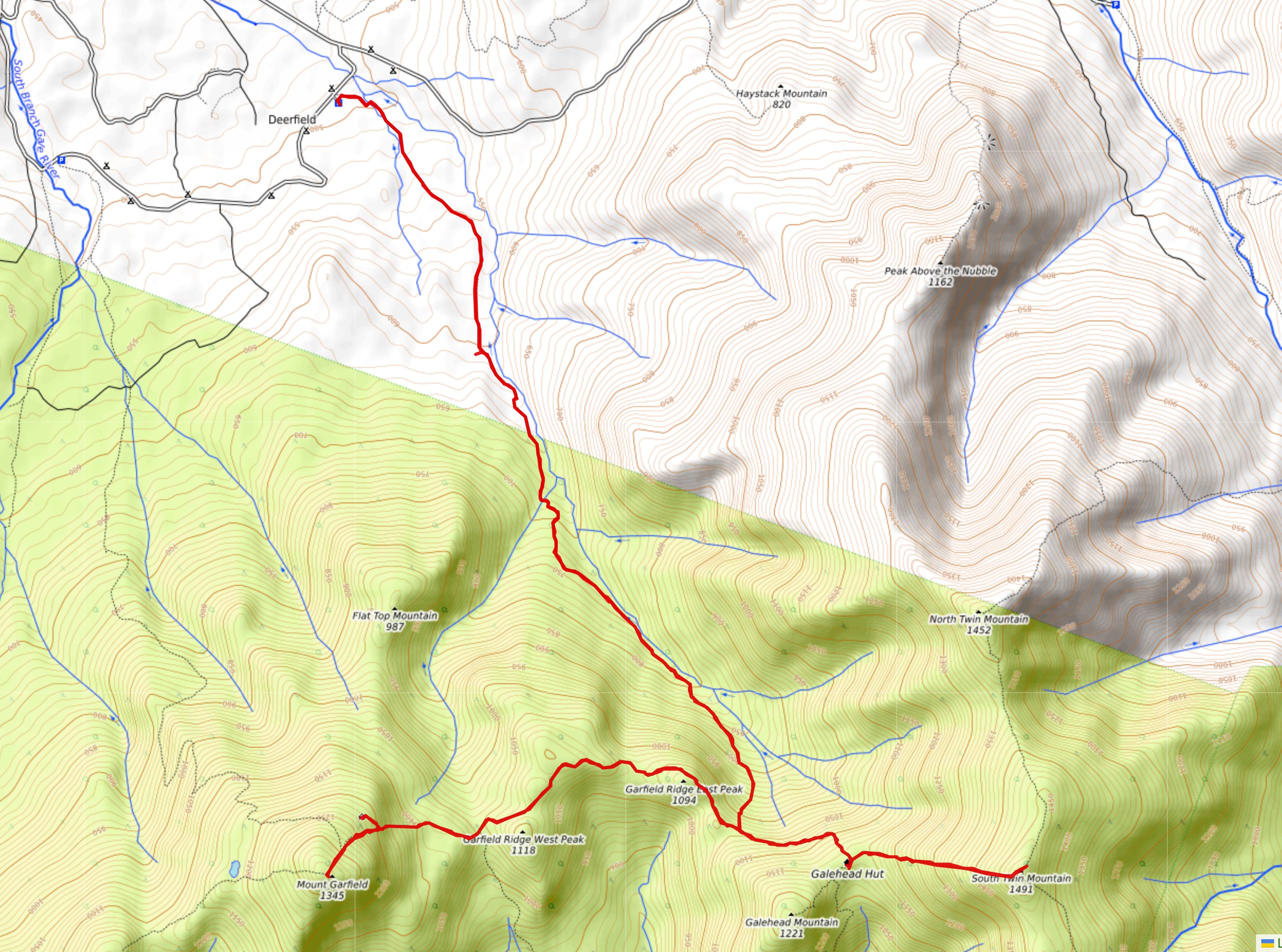
Continuing my assault on the 27.7 miles of roadless Appalachian Trail between Franconia Notch and Crawford Notch, today I inserted myself into the center of this section by means of a 4.0-mile side trail along the Gale River. It follows the valley on nice smooth trail with very gradual elevation change for the first three miles and then has to climb steeply (but on reasonably well-behaved trail) up the head of the valley toward the aptly named Galehead Hut.

After summiting Garfield for the second day in a row it was back the way I came and on north for a visit to the Galehead Hut (not so clean, and just crawling with weekend hikers on this beautiful Saturday) ...

... and on to the summit of South Twin Mountain. From Galehead Hut to the South Twin summit it is only 0.8 miles. But the hut information said it's an hour walk. That's because it's a steep rocky climb of 1000 feet. The views were worth it, though. Here's a look back to the hut with Mt. Garfield behind and then Mt. Lafayette and the Franconia Ridge beyond:

And every day I hike, I come a bit closer to the Presidentials. Here's the view from South Twin summit:


But the bleeding stopped quickly, so no need to head back to the hut for first aid. On I went. Nice views from the open rocky summit of South Twin, then back out of the howling Gale and home, another 3.9 miles of AT completed in another hard 12 hour day. This old body is going to need a break before long.
-------------------------------------
Here's a map of today's route with an elevation profile thrown in just for fun. Only the east-west portion of the route is the AT:

No comments:
Post a Comment