Thursday, June 8, 2017
The Tri-County Triangle Trail - 34 poetic miles
The poetry may be a little cheesy, but the sentiment fits perfectly. When there is no other hiking trail, abandoned railroad rights-of-way are there, ready to support the long distance hiker. In my particular case, when the hiking route proves to be overgrown, thorn- and tick-infested, and with too many long road-walk gaps, and when the existing route following old railroad grades had been developed into paved bike paths ... well ...
These two particular routes diverged at Chillicothe, Ohio. In my last post I discussed the two choices in some detail:
A. Follow the Buckeye Trail from south of Chillicothe to Dayton. This alternative involves 355.0 miles of trail, 192.3 miles of which is road walking including some particularly dangerous road in the vicinity of Cincinnati according to BTA Director Andrew Bashaw, and more than half of the off-road portion is woods walking in State Forest land, which my experience has shown is seldom hiked and unevenly maintained.
B. Take the developed Rail Trails. The Tri-County Trail from Chillicothe to Washington Court House, the Jamestown-Xenia Connector, and then the Creekside Recreational Trail straight to Dayton. Including the 12 miles to get from the Buckeye Trail up to the start of the Tri-County Trail in Chillicothe, this involves 92.2 miles of trail, only 30.4 of which is on roads and virtually all of the rest is paved, tick free, underbrush-free, non-motorized bicycle trail in a wooded corridor.
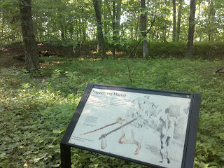
I chose plan B and was rewarded by a trail sprinkled with cheesy poetry on signs like the one up top, with vistas of pastoral farm land,
with creek-side vistas
wooded corridors with rest stops
a few more park-like, developed woodlands,
and with a side trail to explore pre-Columbian history at the Hopewell Mound Group, where traces of 2000-year-old native American earthworks (burial mounds) were on display.
The split from the Buckeye/North Country/American Discovery trail route began with a last trail walk into Scioto Trail State Forest then came back down a forest road to follow beside the Scioto River south of Chillicothe.
It was a fairly pleasant road walk through the country,
then into downtown Chillicothe. Here I found a bike shop where I could have a tune up done to my bicycle. With my second car in the shop for body work, I will be using the bicycle in its place. Here in Chillicothe I hooked up with the Rail Trail at a truly peaceful downtown urban park called Yoctangee Park
The word Yoctangee means "paint" and I had walked Paint Street into town and the bike trail followed Paint Creek for the next day.
Farther west the trail enters more flat, open country, then finally becomes an urban bike trail through the heart of Washington Court House
That's where the Tri-County Triangle Trail ends, and where a road walk of about seventeen miles begins. For the most part the roads were extremely lightly traveled, and I had the opportunity to visit a veteran's memorial in a cemetery between the little towns of South Plymouth and Milledgeville.
I may always wonder what I missed by not sticking with the Buckeye Trail route, but such thinking is a waste of time. Life always presents more opportunities than it is possible for one person to experience. It's making the most of the path you choose that really matters.
Subscribe to:
Post Comments (Atom)


No comments:
Post a Comment