Colorado or Bust, Days 41 through 45:
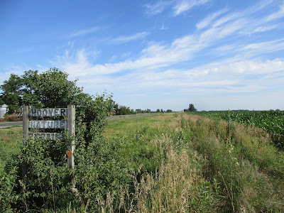
It can't be hiked. That is, where there are trail signs there is trail that has not been maintained this Millennium. Example: here's a wonderful, peaceful rest area with working privy, resting in peace.
What I can't really show is where there is supposed to be trail but there's nothing but impenetrable tangles of weeds and fallen trees that are said to be open trail, but aren't even used by wildlife. Twice I had to bail out and hike an adjacent soybean field in the middle of nowhere, hoping not to lose the route and hoping that the farmer/owner was elsewhere with his shotgun.
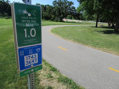
Then there are the parts that are fresh, new high-end concrete bike trail, with visitor centers and bike repair stations, loved by two wheeled denizens and two legged hikers of many sorts.
One part is under construction, with promise of greatness.
There are some parts that split the difference--passable, quaint, very rural.
Amazing variety, really. Then there are the parts that never existed. The parts you have to walk roads.
The trail is named for the 31st president, Herbert, who presided over the crash of '29, the greatest economic swing in this country's history. From great to nearly intolerable in such a short span of his four year presidency. I suppose that justifies what I found on his trail. It does pass by the Presidential Library and birthplace in West Branch, Iowa. Fittingly, the trail isn't finished through that National Park unit.
Okay, well, let's just end this Jekyll-Hyde report with my favorite part of this five days of Hoovering. A cool, vaulted canopy of black locust near Ely, Iowa, on a hot afternoon:
Here are the five GPS track maps for this Trail-that-Hoovers:
UPDATE posted 16 Nov 2024.
In response to the wonderful comments by Shawna (see comments at the end), I checked the current internet info on Hoover Nature Trail. The trail route from Muscatine north remains part of the American Discovery Trail through Iowa. There is a Wikipedia Page, but it hasn't been updated with any substance since 2012, and information that is linked to from the Iowa Natural Heritage Foundation are dead links too, though key pages were archived. Below are screen shots of that archived information page and a 2012 master map of the entire Hoover Nature Trail system, marked in green, with planned sections as dashed lines and constructed sections (though not necessarily maintained) as solid lines.


It hasn't been maintained consistently since slightly before 1994 when my grandmother who started it declined rapidly and passed away quite suddenly from cancer. The deals made with farmers and the railroad were based on agreements of shared land and things I was too young to understand. Unfortunately almost none of it was fully detailed in writing and I would guess the legal system moved slower than my grandmother did. The legal declarations needed on the sections of land were not in place despite the fact it was being developed and in many cases was already divided off from the main parcel of land with Hoover Nature Trail being added as an owner. I would ride along in the ancient steel body Ford truck with eventually some extra trail signs bolted over the rust holes in the floor boards while my grandma and grandpa inspected and cleared the trail themselves. Cutting the low limbs or downed trees to drag out of the way and keeping the other plants trimmed.
ReplyDeleteIt was a tremendous undertaking with more details than likely anyone alive knows about. It required at least 100s and possibly even 1,000s of people to all agree with the idea for a public trail through the edge of their land.
The committee had no idea what to do when my grandmother passed away. She declined so rapidly that some showed up in her hospital room to request she sign some papers only to find she was in a coma she never woke up from. Not knowing how the deals being made were supposed to work they believed they were in massive debt to the railroad company and cities tried to buy the land from the farmers instead of agreeing to right of ways or essentially a local equivalent of "freedom to roam" laws that you'll find in some European countries. It allows owners full control of their property but also makes it a requirement other's have the ability to cross the land.
When the nearby cities tried to continue developing the trail they did not like the agreement to share land and people did not want to just hand over a chunk of their land. If you look on the GIS maps for the counties, especially the section in southern Cedar county, you can see the parcels for the trail are still separated off with often half on one person's property and half on another's. Everyone was equally giving up land for the public right of way and doing it that way would have required twice as many people to be willing to allow it.
It saddened everyone to lose the future trail and several related projects but no one else could bring them all together and agree how to complete the entire thing. My mom tried. My grandpa eventually helped get some sections completed. They are not Milly Gregg and that name will still get the attention of anyone who spent enough time in West Liberty prior to her death.
It is not illegal to cross private land in Iowa unless it is posted or you are asked to leave. Criminal trespassing only occurs if you cause or intend to cause damage or have been notified you cannot be on that property. You cannot place anything or take anything from the property including wild plants but you can legally cross any property in Iowa you have not been informed to stay off of if you do not alter or do no harm and it does not violate any part of a basic right to privacy section of the law. It is common courtesy to ask though.
While those properties that did not sell to the nearby town increasingly belong to the descendants that were young children when their parents or relatives were helping lay out the course of the trail or the land has been sold; many will still allow you to follow the line of parcels you can see on detailed lot maps like the Geographical Information System. If that is all you intend to do. I continued to ride horses down some of those areas that are still considered private property until I married and moved to another town in 2009.
Wow, Shawna! Thank you for taking the time to write such a comprehensive story of the history of this trail. Milly Gregg--a name I had not heard--deserves to be remembered and memorialized for her pioneering work. Thanks for the clarification of the property and trespassing laws/regulations.
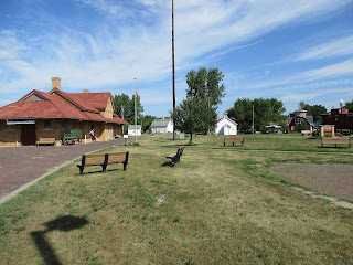
DeleteThere was an engraved stone bench dedicated to her at the West Liberty depot. I helped haul the old mail bags left behind in the section off the unloading platform. Many still full of undelivered mail. I don't know why. It was also not completed before she passed away. The last time I saw the inside with my grandparents it was thoroughly cleaned up, repaired, and the display cases had been arranged to hold items from the historical society. Then the contents of the former historical society building ended up in my grandpa's extra bedroom and machine shop. I'm sure some was moved in after others finally got motivated to complete the restoration of the depot. After my grandpa passed away my mom further donated things to historical organizations in the area.
DeleteThe trail now continues past Ely through Cedar Rapids to Center Point. The name switches in some places and eventually becomes the Cedar Valley Nature trail. Some trails are being connected to it like the Grantwood Trail. It was a railroad line running above a peat bog.
https://cms8.revize.com/revize/cedarrapids/Community%20Development/Trails/2023-2025%20Trail%20Map.pdf
https://photos.app.goo.gl/BtPzAytNJWmmZE6z8
https://photos.app.goo.gl/3dVHLWmQiYof6bmp7
https://photos.app.goo.gl/1em7UVsxC32WfY2W8
It is still becoming a more extensive trail system. There are just problems with sections of the original Hoover Nature Trail that no one can agree how to manage and develop. It is unfortunate as more trails keep coming off the completed sections. It would be a lot of area to travel easily without having to walk down highways or drive between sections if it had a continuous center like intended. It falls to a variety of groups working in their local area now instead of one widespread plan.
Thanks again, Shawna. The restored Depot at West Liberty is one of the highlights of this trail. I stopped in and talked to the lady who was on duty and looked over the displays. I wish I had noticed the bench you mention.
Delete