Saturday, August 22, 2015
Starting the new adventure, hiking to Florida from the AT
Here is where the trails fork, and this time I'm taking the "road less traveled".
It was the morning of Day One of my 'hike to Florida'.
I started the day at Three Forks, which is the second road the Appalachian Trail crosses as it winds northward from its southern terminus at Springer Mountain. All but the least ambitious Northbound AT through hikers would pass this parking area on their very first trail day out. It is 4 1/2 miles from Springer Mountain.
As I hit the trail I met some trail maintainers from the local Georgia Club and talked to a lady who knew AT Conservancy board member Lenny Bernstein (who I had met while hiking the AT in the area of Sam's Gap where he maintains a section). She also knew quite a lot about North Carolina's Mountains to Sea Trail. It was a short chat, as her first task was to take water quality samples from Long Creek not far from the parking lot.
Half a mile later I was at the side trail to beautiful Long Creek Falls:
And that is where the Benton MacKaye Trail and the AT part ways (photo up top). My plan is that I will head northwest on the BMT for about 65 miles to where the Georgia Pinhoti Trail splits off and heads west. My route then takes me the full length of the Pinhoti Trail through Georgia and northern Alabama. From there I will use a road walk connection established by the Great Eastern Trail to get to the Florida border where I'll pick up the Florida Trail.
That's the big-picture plan, and it fits into an even bigger picture--my 'Personal Continuous Footpath'. I'm laying down footprints via connecting trails and road walks that are uninterrupted--all one big web of foot trail that includes the Appalachian Trail as its spine but has also seen me connect to my Topsail Island home via the Mountains-to-Sea Trail and to many places I've lived in Maryland and Delaware via bits of the American Discovery Trail and other trails. The goal of this 'Personal Continuous Footpath' is to connect, on foot, with every house or condo or apartment or dormitory, etc., that I've ever lived in. Since I'm buying a place in Florida in order to take up residence there next, it's my winter project to hike to the front door of that new home. But ...
Today's endeavor was much smaller in scale--to settle in to the Benton MacKaye Trail and get used to following its white diamond blazes.
As I suggested above this trail is far less used than the Georgia AT, yet it is well maintained and blazed and easy to follow. After Long Creek Falls it climbed up to a ridge and followed that for five miles or so before plunging about 1200 feet in elevation to the Toccoa River where the US Forest Service and Georgia Appalachian Trail club have built a most impressive suspension foot-bridge. It's no small river.
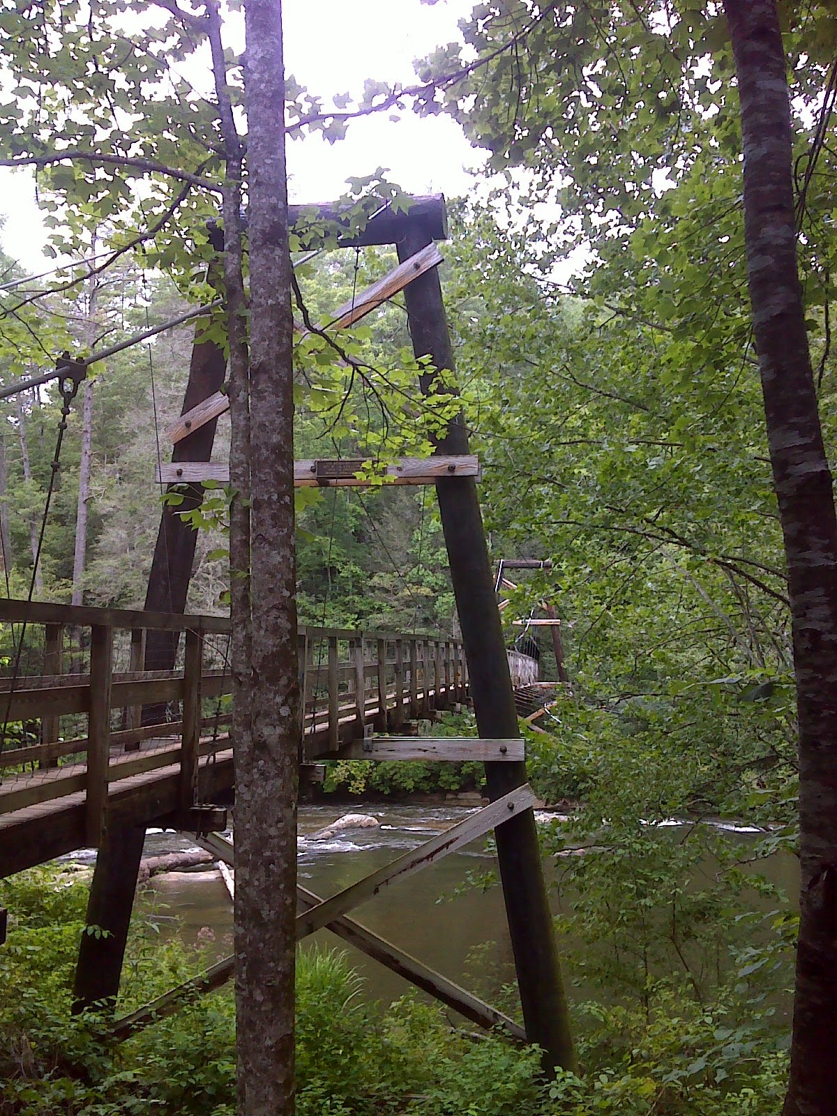
That was my turn-around point for a 16 mile day. Weather was cool and humid, but reasonably comfortable. I'd say that the new adventure is off to a good start.
Here's a map of the out-and-back hike I accomplished today--about 8.3 miles of trail including one mile of AT that I had hiked in 2012.
Benton MacKaye Trail - Three Forks to Toccoa River at EveryTrail
EveryTrail - Find hiking trails in California and beyond
Thursday, August 20, 2015
Hike through Gold Head Branch State Park, Florida Trail
![]() |
| The apparition at the end of the trail. Several months from now I hope to be back here to greet ol' Moss Man again. |
This is the start of a new hiking adventure--a southward hike into Florida from the North Georgia mountains. But just for kicks and wiggles I'm starting by visiting the endpoint and will report the beginning in a couple days.
The adventure is this: To extend my 'Personal Continuous Footpath' - an uninterrupted string of my footprints on the ground - from the southern end of the Appalachian Trail down into north central Florida via the Benton MacKaye Trail, The Pinhoti Trail, the Great Eastern Trail, and the Florida Trail.
It's about 1200 miles of hiking give or take a hundred or two. It begins near where my footprints currently come to an end at the southern Terminus of the Appalachian Trail and will end, if all goes well, here near Gold Head Branch State Park in Clay County, Florida, east of Gainesville, where I hope to purchase a modest place on a small lake. The goal of the PCF is to walk to all the places I've ever lived in my life, and in this case I'm starting the walk even before I set up this new residence.
Gold Head Branch State Park features a lush tropical ravine out of which fully formed streams spring from the sand. It reminds me of some of my favorite lush tropical places in Hawaii except that the crystal clear stream has a white sand bed.
It also features the dry sandy uplands where fire-regulated longleaf pine savanna ecosystems thrive.
And lastly, it is the site of several lakes including this cute sinkhole-created one called Devil's Washbasin, which the Florida Trail passes.
I hiked just a few miles of Florida Trail along with some other trails around the park--just a five mile hike on a steamy August morning, and spotted mid-summer bloom and a few more permanent residents (besides Moss Man).
I'm looking forward to taking in much more, but first it's back north to the mountains of North Georgia where it ought to be cooler. Stay tuned.
Below is a GPS track of the hike route through the park:
Florida Trail - Gold Head Branch State Park at EveryTrail
EveryTrail - Find the best Hiking in Florida
Monday, August 17, 2015
Hiking to the brink of the fire - Woods Mountain
The Mountains-to-Sea Trail is on fire.
I didn't know it. I have been hiking the MST steadily west to east from Waterrock Knob. On Mount Mitchell the other day I could plainly see a nasty plume of smoke off to the northeast. It looked farther away than it was. Two days later, hiking on Woods Mountain, I was immersed in that smoke. It was so thick that the visibility was down to a mile and breathing was a bit uncomfortable.
![]() |
| Smoked obscured vista on the slopes of Woods Mountain on an otherwise beautiful sunny day |
Still, I didn't know for sure whether the trail was closed ahead. I had not been checking in on the Friends of the Mountains-to-Sea Trail's web site, or I would have known.
Then I emerged at the Woodlawn Work Center and saw the sign. End of my road. I could hike a few more miles to the Catawba River Bridge but then would have to bypass a big chunk of trail.
Here's the detail: The Bald Knob area of the trail has been closed between the Catawba River and Forest Road 106 near Linville Gorge since Mid July. The photo up top is from the current incident report. In the map immediately above, the MST is the fine dotted line that runs right through the red-hatched area. Looks nasty. Current estimate is that the fire won't be controlled for another three weeks--September 10th.
So my options were to do an alternate route or jump ahead, skipping the closed section and returning to do it another time. It didn't take long to make up my mind. I've been hiking these mountain miles of the MST without any set goal. I'm not thru-hiking, and I have no deadline in mind for completing the trail, so I have chosen to move on, do some hiking on the Benton MacKaye Trail and Pinhoti Trail in north Georgia, and come back to the MST another time. Unlike with this piece of the MST, I have a larger purpose for hiking the North Georgia trails. The purpose is to extend my continuous trail of footprints southward from the Appalachian Trail, eventually into Florida.
More on that in another post. But first, here are a few of the highlights of my MST hike to the brink of the fire.
Woods Mountain is a distinctive peak. It juts out into the low elevation country north of Marion, NC and was the site of an important fire tower at one time (rather ironic, come to think of it). Coming east from Buck Creek Gap, the MST follows a long ridge, often surprisingly level despite being narrow and occasionally rocky. It was a lot of fun hiking this ridge. It would have been much more fun if I had been able to see more than a mile! This ridge, and Woods Mountain in particular, seem to be made of some especially hard rock. The rock springs from the ground in unusual ways.
And in other places it shows distinctive dark striations in white quartz. This is the most distinctive rock I've seen anywhere on the MST, so I picked up a pebble and am keeping it as my MST souvenir. Below are larger samples that I assembled and lined up as a whimsical trail marker.
On the east side of Woods Mountain, the MST plunges down 2000 feet in a couple miles, crosses Tom's Creek, and then meanders out to the crossing of busy US 221 at the National Forest Service's Woodlawn Work Center. Here I found the only truly comprehensive MST signpost that I've seen along the entire trail.
On the West side of Buck Creek Gap, there is a brand new two mile section of MST between Black Mountain Campground and FR 2074. This was formerly a road walk of about a mile in length. The new trail, which appears to have been open only a few months, is about two miles in length and features a beautifully constructed brand new rustic bridge, made mostly of locust logs.
The woods are pretty here. Even the plants that live here seem to be expressing their love of the place.
I've had a great time trekking 150 more miles of the MST this summer. I estimate that I have another 140 miles or so to do - in three separate pieces including the 60 miles through the burn area between Woodlawn Work Center and Beacon Heights. Long distance hikers often find that when they're coming to the end of their trek a certain melancholy sets in. They don't want it to end. Maybe that's why I'm saving those last miles for later.
Below is a map showing the four out-and-back hikes I did to complete this bit of trail:
MST - Woods Mountain, Black Mtn Campgd to Woodlawn Work Ctr at EveryTrail
EveryTrail - Find the best Hiking in Mount Mitchell State Park
Monday, August 10, 2015
Hiking Mt. Mitchell - and almost to Heaven
I love hiking early in the morning. It's a time that I can hear my heart and feel my breath. The wind goes quiet and the smell of earth and green is in the air. Leaves are dripping the last remnant of the sun-fueled thunderstorms of yesterday. The moss drinks in the dew, the wood thrush serenades me with her territorial claims, and the sun fills the forest with filaments of fresh-risen mist.
It was a magical time, this particular morning. Before me the gates of heaven seemed to be opening, luring me upward as I climbed to the highest point that was part of the United States prior to the Louisiana Purchase.
And when I got there I had the place all to myself!
Mount Mitchell is a popular tourist destination because the hike to the summit from the parking lot, gift shop, and concession stand is a gradually-graded quarter mile stroll.
But tourists are not early birds, I got there soon after the gate opened at 7AM and did a loop hike with 1000 feet of descending on the Mitchell Trail, a half-mile connection on the blueberry lined Commissary Trail,
and 1000 feet of climbing on the Camp Alice and Old Mitchell Trails. And when I got back to the stadium-sized summit parking lot at 10AM there were still only a handful of cars.
A dozen eager day hikers were gathering for a Carolina Mountain Club "Mount Mitchell Ramble". Four teen girls couldn't find the start of the summit trail. An older couple cruised up in their snazzy top-down BMW convertible. A trio of rolling-thunder Harley riders arrived, seeming to be expecting more companions. I could hear the rumble down below.
The world was waking. Time for me to move on and find a quieter piece of trail.
The day before I had hiked up from Balsam Gap, where I found definitive proof that hiking can slim your figure.
![]() |
| Balsam Gap, where the MST junctions with the Big Butt Trail. The sign says 'Little Butt - 3 miles'. Put in the miles and you'll get your reward. |
On the way down from Blackstock Knob I paused to emblazon a mossy trailside log with a bit of guidance for those who would come after.
And I strolled the Parkway high above Asheville's scrupulously pristine watershed.
Surely no city east of the Rockies has more control over the source of their water. It's probably why several big western mega-craft brewers such as Sierra Nevada and New Belgium are flocking there to build east-coast breweries. Once the rain hits the ground it's protected like gold in Fort Knox. Unfortunately Asheville has no control over what's in the rain, and their population contributes its share to the toxic sputum that taints the rainclouds.
On the east side, the following day, I came the rest of the way down the venerable old Mitchell Trail to Black Mountain Campground. This is a trail that is much older than the MST, and its 3700 foot climb over 5.8 miles from campground to summit has long been a popular day hike for the ambitious and the eager, the fit and the foolhardy. The unwary and inexperienced will find that the descent is tougher on the legs, especially the knees, than the climb. There is a set of subtle skills to descending for long distances that only seasoned hikers learn. Vary your stride, walk bent at the waist at times, walk sideways for a while, let your weight fall rather than using muscles to control it. These are techniques that are easier to do than to describe, but they do not come naturally. They are usually learned the hard way.
The Mitchell trail shows its age. It is deeply rutted by a hundred years of trampling and erosion, exposing the raw flesh of clay subsoil and the bones of tree and mountain--roots and bedrock. It's very reminiscent of many of the popular trails in the White Mountains of New Hampshire, both in the vegetation and the character of the footing.
In the middle of this ascent/descent, the MST shows the observant hiker the contrast between old and new trail. Between 4300 and 4800 feet elevation there is an alternative, amateur/volunteer-constructed new trail called the Higgins Bald trail (though there's no actual bald). I wouldn't recommend this detour, since I enjoyed the Mitchell Trail alternative much more despite the erosion, but for reasons that escape me, the MST routes the hiker up/down Higgins Bald instead.
At the end of the day, down in the valley, Black Mountain Campground got my attention. I decided to stay the night when I learned that my National Parks Golden Age pass gave me a tent site for half price - $11 for a tent pad, fire ring, drinking water, super-clean hot showers and flush toilets, and a store that sells t-shirts and ice cream, not to mention the Toe River rushing past, with its fishing and splashing opportunities. Here's where it literally pays to be old.
Below is a map of my ramblings during three days of out-and-back day hikes centered on Mt. Mitchell:
MST - Mt. Mitchell, Balsam Gap to Black Mtn Campgd at EveryTrail
EveryTrail - Find the best Hiking in North Carolina
Saturday, August 1, 2015
What's blooming at Craggy Gardens
![]() |
| The purpose of a flower is to draw attention to itself. For my money, none of the high mountain mid-summer flowers around Craggy Gardens do a better job of that than the Turks Cap Lily |
Craggy Gardens is one of North Carolina's mysterious high mountain summit balds--peaks and ridges that are free of trees even though the climate is warm enough to support them. Nobody knows for sure why these false-tundra remnants of the ice age linger on selected summits in the southern Appalachians. But whatever the explanation, I love them. The Roan High Balds on the Appalachian Trail are larger and 'balder,' but as I hiked from Rattlesnake Lodge to Glassmine Falls Overlook, that section of the Mountains-to-Sea Trail instantly leapt to the top of my favorites list.
Ecologically they call Craggy Gardens a 'rhododendron heath' because the prominent plant is the pink flowered Catawba Rhododendron. What I found as I hiked through in late July was that there are also loads of blueberry bushes and the first of these yummy juicy sweet treats were ripe!
What I like most about hiking these open high ridges is that I'm out of the 'Green Tunnel.' There are constant views of the surrounding country and of the weather. The views were prodigious, but in this hike report I'll show just two examples--the view from Lane Pinnacle on a clear Sunday morning, and a view of Mt. Mitchell from near the summit of Bullhead Mountain. I've put many more views and general trail scenes on the EveryTrail trip report linked to via the map at the end. Each of the little red 'push pins' there represents a photo, and most are not shown here because ...
... because the primary focus of this report will be a photo-tour of the abundant mid-summer bloom, both along the Parkway and on the trail. Late July at lower elevations is not so colorful. The spring flowers are done and fall leaf change is still a distant prospect. But up above about 5300 feet, where all the following photos were taken, I felt as though I was constantly walking through a flower garden. At first I just looked, but as I began to note the variety and abundance of bloom, I felt the urge to begin taking photos of each new species I saw blooming, just in order to have a record for future reference. It became a project, lasting three days--stop and smell the flowers!
The photos go somewhat beyond just flowers, as it turns out. I've spent quite a bit of time selecting and preparing about fifty of the best shots. All these photos were taken during three consecutive days of hiking. Not all the species have been identified, but check the captions for my best guess at species or common name. Enjoy.
![]() |
| Another attention-getter, lavender variety of bee balm. Looks like an insect's eye or an alien space ship. |
![]() |
| As mentioned, the blueberries were ripe and abundant. |
![]() |
| Mossy log becomes trail marker |
![]() |
| Bumblebee on 'Green and gold' (Chrysogonum virginianum) |
![]() |
| Dew jewelry on airy grass seed frond |
![]() |
| A touch of premature fall color or just a plant in distress? |
![]() |
| Pivevine (or Blue) Swallowtail butterfly on Joe-Pye weed |
![]() |
| Fungus 'ice cream' - that's not an identification, but an impression |
![]() |
| Tiger Swallowtail Butterfly on Turks Cap Lily |
![]() |
| Blackberries were coming ripe too |
![]() |
| Canadian Thistle |
![]() |
| Filmy Angelica leaf - I saw a number of plants that weren't blooming doing this early color change |
![]() |
| Distinctive blue-green dead wood, common in the Appalachians. The color is produced by the action of fungus as a waste byproduct called 'fungal laccase' that contains an oxide of copper. |
![]() |
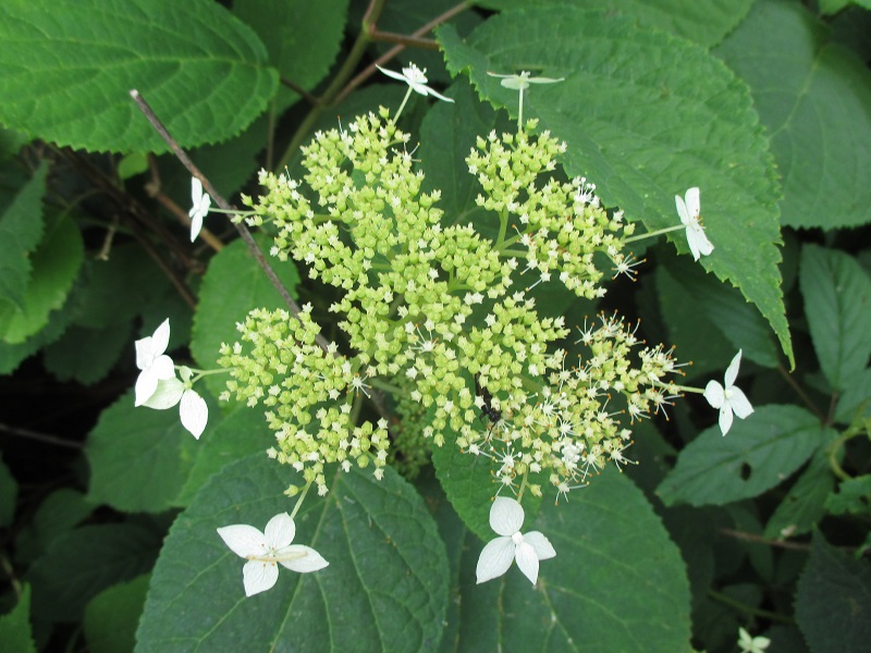
| Wild hydrangea has this wild whimsical way of getting attention to its mostly green flowers |
![]() |
| More dew-jewelry on grass seed |
![]() |
| Red variety of bee balm - a real show-stopper |
![]() |
| Yellowjackets seemed particularly attracted to this wild clematis, the Virginia Bower Vine |
![]() |
| Berries of the hobble-bush, a member of the viburnum family, were just beginning to turn |
![]() |
| The last of the rosebay rhododendron were still blooming in shady areas |
![]() |
| Bluets |
![]() |
| Black-eyed Susan |
![]() |
| Carolina White-Blaze ssp. MST-ensis |
![]() |
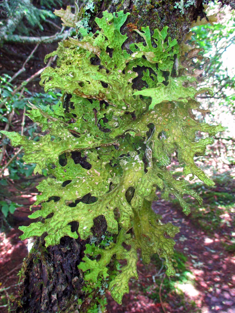
| An amazing example of convergent evolution. This lichen species masquerades as the Carolina White Blaze, fooling many an unwary hiker and luring them to inevitable missteps. |
![]() |
| Fraser Fir |
![]() |
| Filmy Angelica. The flowers are said to be intoxicating to insects. The ants really loved this one. |
![]() |
| Trailside yellow birch with attitude. This species often develops amazing character as it grows old. |
![]() |
| Jewel Weed |
![]() |
| Bold variety of lichen. I thought this was called 'staghorn' or something like that, but can't nail down the identification. |
![]() |
| Male Tiger Swallowtail on Joe-Pye weed - this guy has one missing 'tail' |
![]() |
| Moss and mushroom |
![]() |
| Mountain Laurel going to seed - in profusion |
![]() |
| The parasitic vine 'Dodder' - Cuscata gronovii - in bloom. A few of its characteristic twining orange 'tentacles' also visible |
![]() |
| wild Phlox |
![]() |
| Queen Anne's Lace |
![]() |
| Good old pink clover beside the Parkway |
![]() |
| Stinging Nettle Plant |
![]() |
| Pink Turtlehead, relative of the snapdragon |
![]() |
| Cutleaf coneflower |
![]() |
| Haven't identified this one, not very common, at least here. |
![]() |
| White wood aster |
![]() |
| Black eyed Susan, an interesting variety. Note the tiny little yellow florets between each petal. |
![]() |
| Variegated blackberry leaf with a common diminutive grass weed with showy purple flowers - I should know this one, but I don't |
![]() |
| ... all brought to you by this Fuzzy Curmudgeon |
Below is a map of the trails and Parkway hiking that produced the above show:
MST - Craggy Gardens, Craven Gap to Balsam Gap at EveryTrail
EveryTrail - Find the best Hiking in North Carolina
Subscribe to:
Posts (Atom)